
Walking a line with GPS
The fastest way to map a line that is already up: walk it with your phone. The Tracker draws the line from where you walk. It is on the phone only.
Set it up#
Tap Tracker on the bar and pick how the line gets drawn.
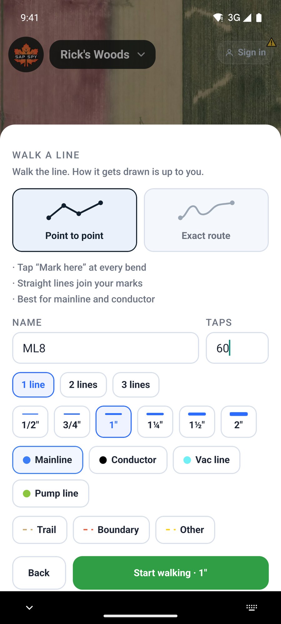
- Point to point: you tap Mark here at every bend, and straight lines join your marks. Best for mainline and conductor.
- Exact route: just walk, and the phone records the path with every bend and wiggle. Best for trails, boundaries and creeks.
Set the name, taps, size and type the same way as for a drawn line, then tap Start walking.
Walk it#
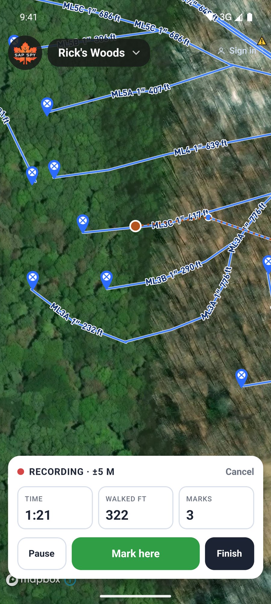
- Stand at the start of the line and tap Mark here.
- Walk to the next bend and tap Mark here again. The card counts your time, the feet walked and your marks.
- Pause if you have to step off the line. Resume when you are back on it.
- At the end, tap Finish.
The top of the card shows how good the GPS fix is. Wait for it to settle before your first mark. The map follows you as you walk and the screen stays on.
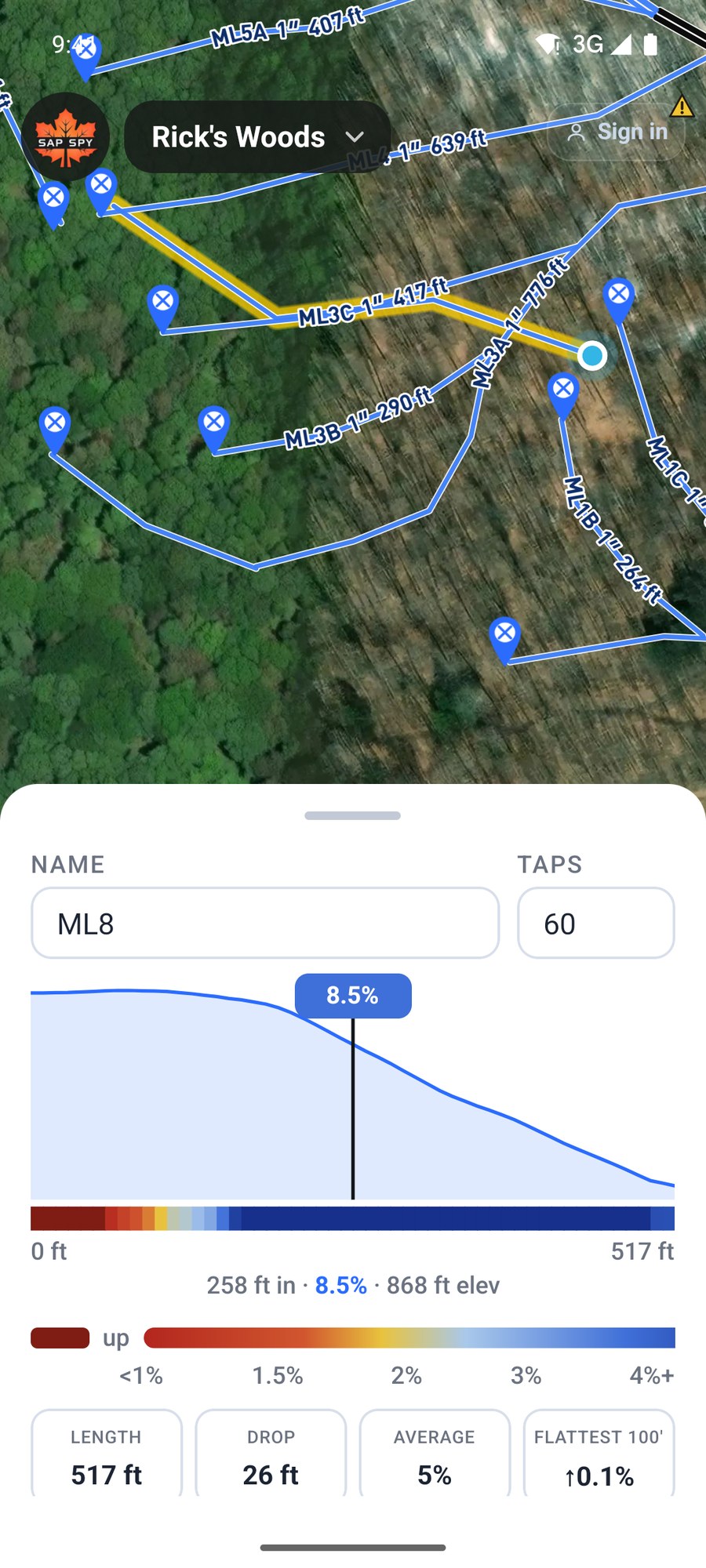
The finished line opens like any other, with its length and grade.
FAQs
As accurate as your phone's GPS: often within 10 to 15 feet in the open, less under heavy cover or in a steep hollow. Leaf-off is better than leaf-on. If a point lands off the line, open the line and fix it with Edit shape.
No. GPS works without cell service. Save the map for offline first so the aerial photo is there too; see the article on working without a signal.
No. Open the same map on your phone, signed in to the same account.
Have a question this doesn't answer? Email info@sapspy.com or call 920-809-4811 — we're producers too.
This website uses cookies that help the website to function. We use these cookies to provide you with improved and customized user-experience. By tapping 'accept,' you consent to the use of cookies. For more info, see our privacy policy.