
How high to hang a mainline
A mainline hangs on its wire above the ground, not on it. Tell Map My Woods how high each corner hangs and the grade is read off the pipe itself: a line over a small dip stops showing uphill, and you can plan a trail crossing high enough to drive under while the line still holds its grade. Set the heights yourself, or let Auto heights work them out.
On your phone#
Tap a mainline on the map, or tap it in Content. Under the pipe sizes is Height off the ground.
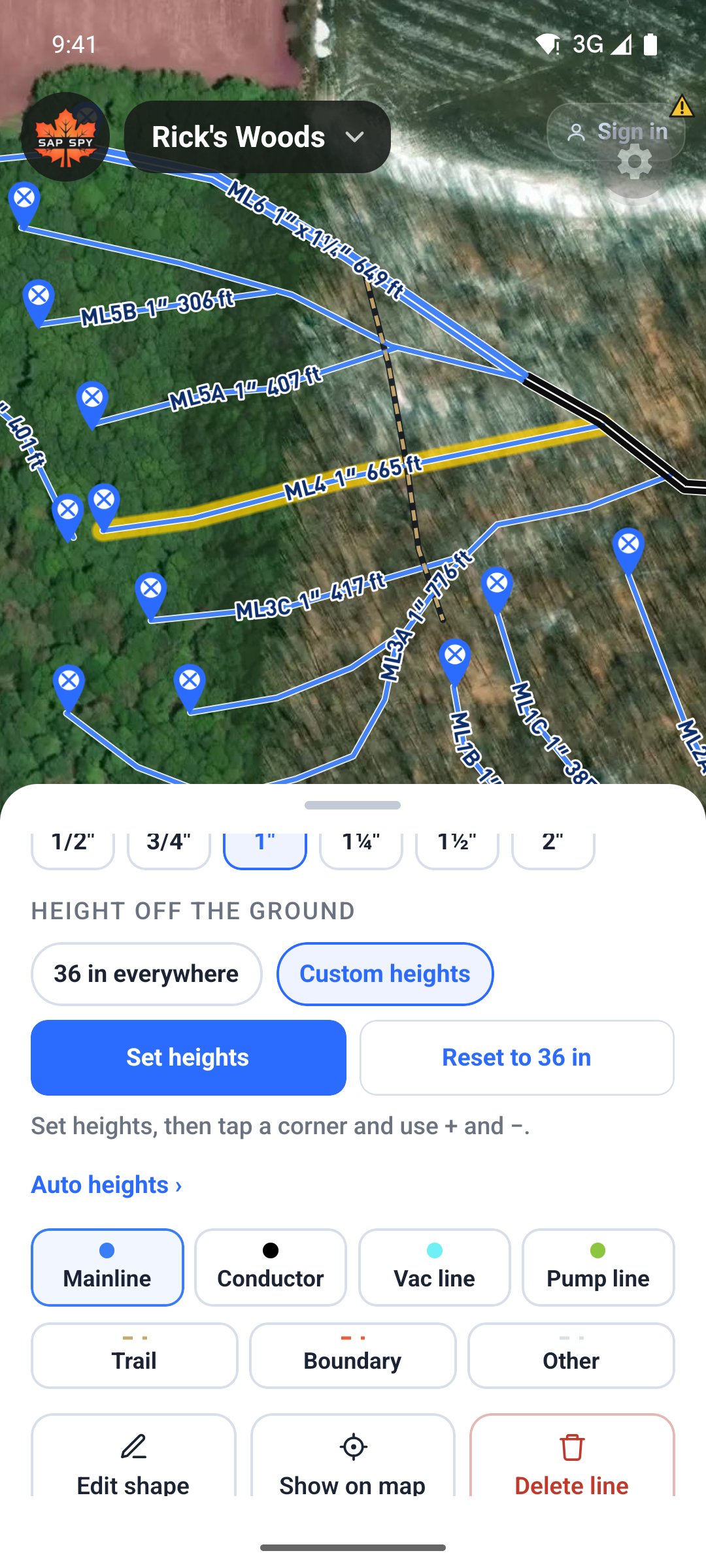
- 36 in everywhere is where every line starts. Every corner hangs 36 inches off the ground, so the grade is the same as the ground's.
- Custom heights lets you set each corner yourself. It adds Set heights, Reset to 36 in and Auto heights.
Setting a corner#
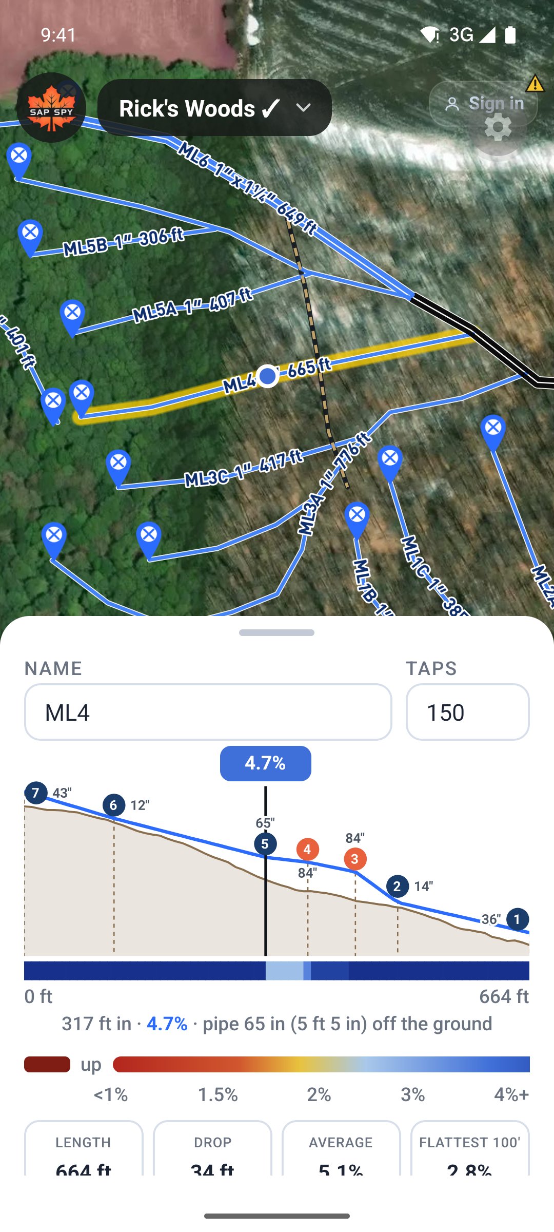
Tap Set heights. A panel at the top of the screen shows the line's profile with the pipe in blue over the ground in brown, and each corner is numbered, on the profile and on the map.
Tap a corner, then use + and −. Each press moves it 2 inches, and holding the button keeps it going. The reading under the profile jumps to that corner, so it shows that corner's height. A corner you set turns orange and says Set by hand; Let Auto set it hands it back.
When you let go, every corner you have not set follows: it is filled in by Auto heights (below) to hold your grade, aiming for 36 inches. So set the corners you know, such as the heights you measured or a trail crossing, and the rest take care of themselves.
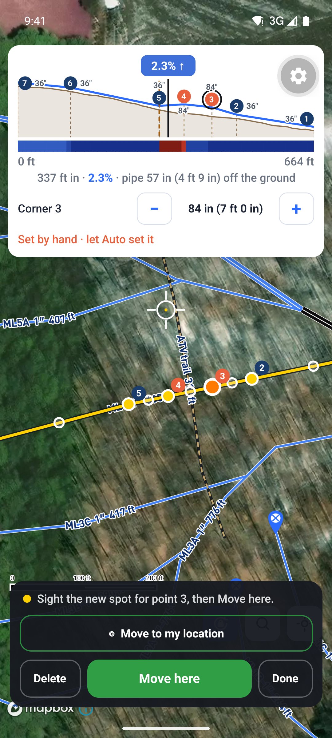
Tap Done when you have what you want. The pipe runs straight from one corner to the next, the way a mainline does once it is tied and the sag is taken out, so put a corner wherever the line is tied or posted.
Reading the height where you are#
Back on the line's card, the profile now draws the pipe over the ground, with each corner's height beside its number. Slide your finger along it and the readout gives the grade and how high the pipe is at that spot, for example pipe 84 in (7 ft 0 in) off the ground. That is the number to measure up from the ground when you hang it.
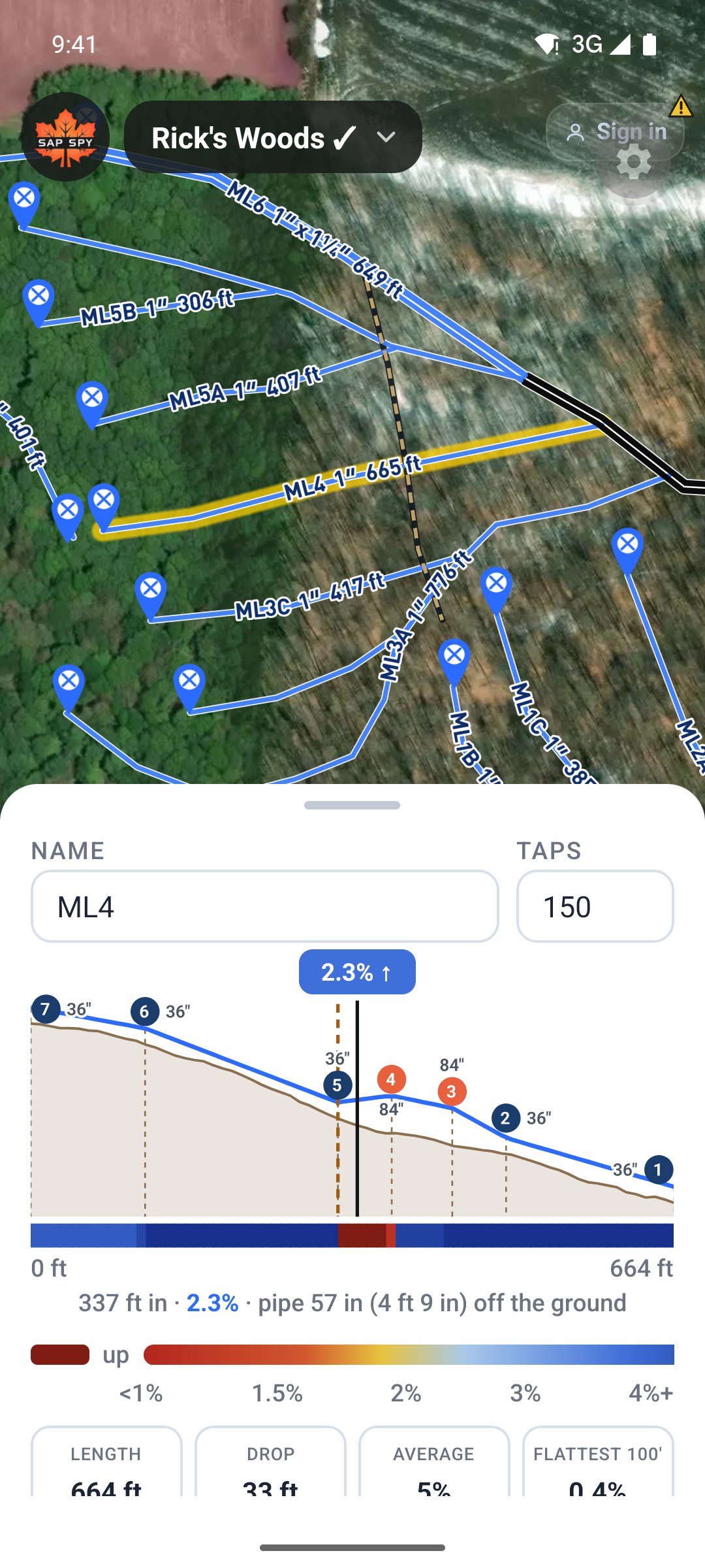
The colour bar, the tiles, Line grade shading and Sap Flow Simulation all read the pipe, not the ground.
Auto heights#
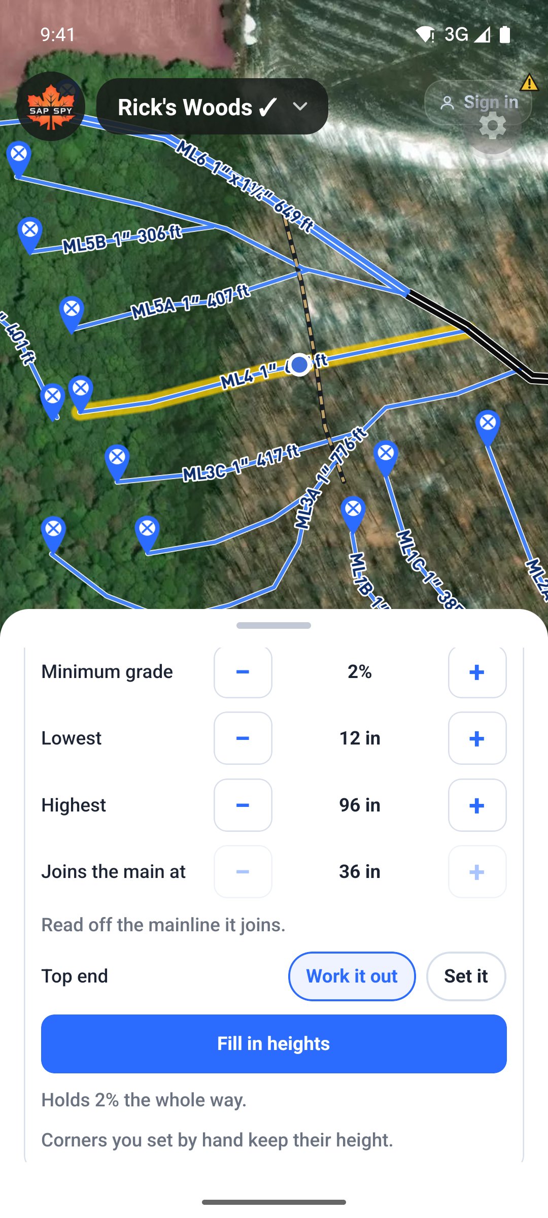
Auto heights runs every time you let go of + or −. Its settings are under Auto heights on the card; after changing one, tap Fill in heights to run it again. It sets every corner you have not set yourself to 36 inches where it can. It goes higher where the line needs it to keep falling at least the Minimum grade. Over a little hill, the corner on the hill comes down, as low as the Lowest height, so the corners above it can stay at 36 inches. For that to work there needs to be a corner on the hill, so add one with Edit shape if the line runs straight over it.
- Minimum grade starts at 2 percent.
- Lowest and Highest are the limits for the whole line: 12 inches and 96 inches to start. No corner goes over the highest.
- Joins the main at is the height of the mainline this one runs into, read off that line. A line that joins nothing starts at its Low end height.
- Top end is worked out, or set it yourself.
Corners you set by hand keep their height. It tells you if the grade holds the whole way, or names the stretch that cannot and the best grade it gets there.
A trail crossing#
Draw the trail, then on the mainline set the corners on either side of it to about 84 inches with +, so an ATV fits under. Tap Fill in heights and the corners above the crossing rise just enough to keep 2 percent falling into it, and the rest stay at 36 inches.
On a computer#
Click a mainline. Its card has the same Height off the ground section under the grade profile. Choose Custom heights, then Set heights: every corner on the map is numbered. Click a corner and use + and − on the card; hold the button to keep stepping. The other corners follow when you let go, and Auto heights works the same as on the phone. Click Done editing shape when you are finished, and Save to keep it.
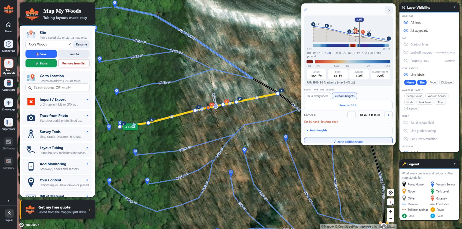
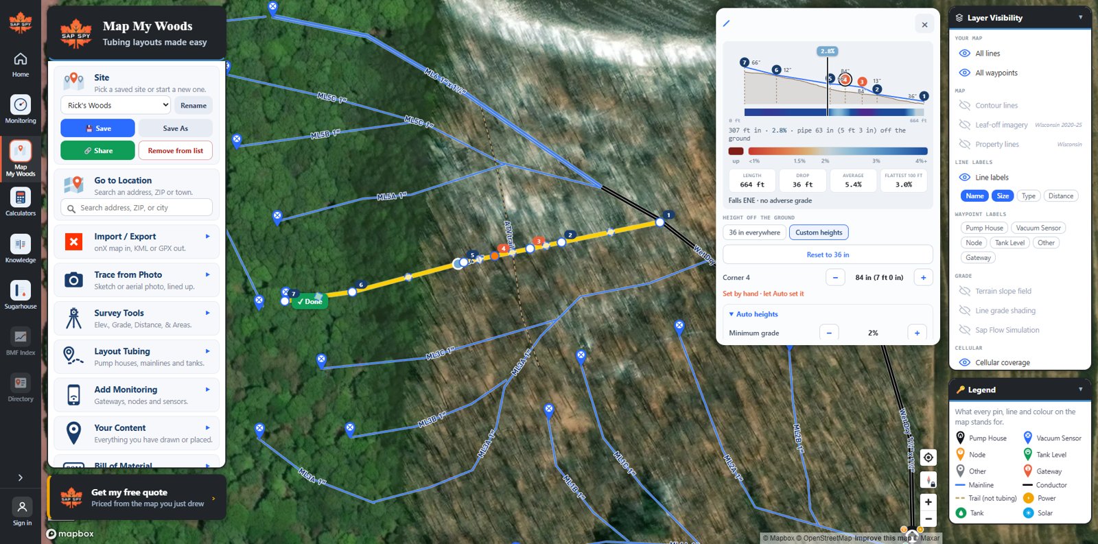
Heights set on the phone show up on the computer and the other way round.
FAQs
No. Heights change the grade the map reads, not the footage or the fittings.
Each corner keeps its own height. If you delete a corner, its height goes with it, and a new corner starts halfway between its neighbours. Reset to 36 in puts every corner back.
No. The pipe runs straight between corners. To change the height partway along, add a corner there with Edit shape and set it.
Set the corners on either side of the dip a few inches higher, or let Auto heights do it. The grade reads the pipe once the line is on Custom heights.
As good as the ground under it: 1 meter LiDAR over most of the US maple region, coarser in Canada. Treat it as a plan and check with a level before you build.
Have a question this doesn't answer? Email info@sapspy.com or call 920-809-4811 — we're producers too.
This website uses cookies that help the website to function. We use these cookies to provide you with improved and customized user-experience. By tapping 'accept,' you consent to the use of cookies. For more info, see our privacy policy.